While reviewing the potential impact upon historic resources in northwest Tennessee, we had an opportunity to perform a Historical Architecture Survey. This survey entailed of recording over 250 structures that were older than 50 years old. I performed the field reconnaissance and our architectural historian, Chris Baker, evaluated these places based on documentary evidence.
The location was Paris, Tennessee, county seat for Henry County. Paris is home to the World’s Biggest Fish Fry. Founded in 1823, Paris has been the center of commerce and politics for the region. It was also the scene of a skirmish during the Civil War. However, in the 20th century two events would change and expand Paris. In 1944, Kentucky Lake was created by the Tennessee Valley Authority through the impounding of the Tennessee River. After the Second World War, major infrastructure projects took place across the country including the growth of the highway system. This lead to the expansion of Paris beyond its historic core including to the east along US Route 79 (E Wood St).
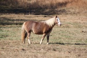 I had the opportunity, over four days, to walk through the neighborhoods of Paris and see the different expressions of architecture in this city. From the stately manors along Chickasaw Road, the commercial center along E Wood Street, and to the quiet streets near the Henry County Fairgrounds. The buildings expressed the economic hope and optimism of the 1950’s and 1960’s. The northern end of my radius included farmland where curious dogs and horses wondered who this stranger was and why was he taking pictures.
You can look at a place from aerial photographs, you can look at photographs others have taken of an area, you can drive through an area, but you never really learn about a place until you have walked upon it. Walking affords you the opportunity to feel the micro-changes in the terrain. Your other senses, sight, smell, sound, taste, and touch help to provide a complete picture of a place. You see the buildings, landscape, and people of a place. You smell the food, plants, and traffic of a place. You hear the animals, children, conversations, and traffic of a place. You taste the air and if you are lucky the food of a place. And finally you touch the ground, plants, and structures of a place.
W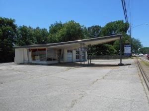 hile documenting the structures in Paris we are also collecting data to access these properties. The assessment is done to determine if they may be eligible for listing upon the National Register for Historic Places (NRHP). With a combination architectural styles popular in the post-WWII era (contemporary, minimal traditional, ranch, shed, and split-level) the neighborhoods of the eastern side of Paris are a reflection of that time. After this data was collected it was given to the Tennessee Historical Commission so that it may provide a tool in the future with regards to planning decisions. The architectural survey is a means to evaluate the impact that a proposed development project would have upon historic resources also provided a means to better understand these resources in the future. It is this way that the work that Aarcher performs is a benefit to our clients and to the communities we work in.
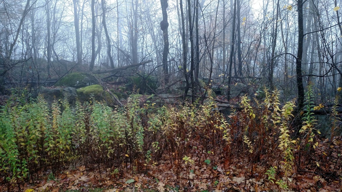
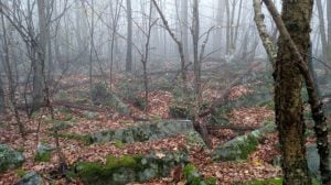 Back to the eerie mountain top. I find myself there to access the direct effects that constructing a tower compound will have on potential historic resources. They are potential because this area had not been previously tested by professional archaeologists. So there was the chance that there could be something here. I am there with my trusty tools: shovel, screen, and trowel. Before digging can commence, a walk-over of the project area is conducted to locate historic resources on the surface. And that is when I saw it.
 First I would need to change my tool. I found a fallen stick about my height and used my machete to trim the twigs off of it, creating a probe and walking stick. I had three things to worry about: wet leaves, wet moss, and wet rocks. Second, I walked around the perimeter of the project area placing flags so that I could turn the project area into a grid. Third, I slowly walked the X- and Y-axis of the grid to look for signs of human activity.